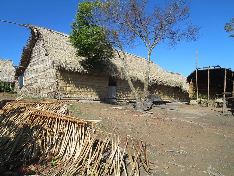
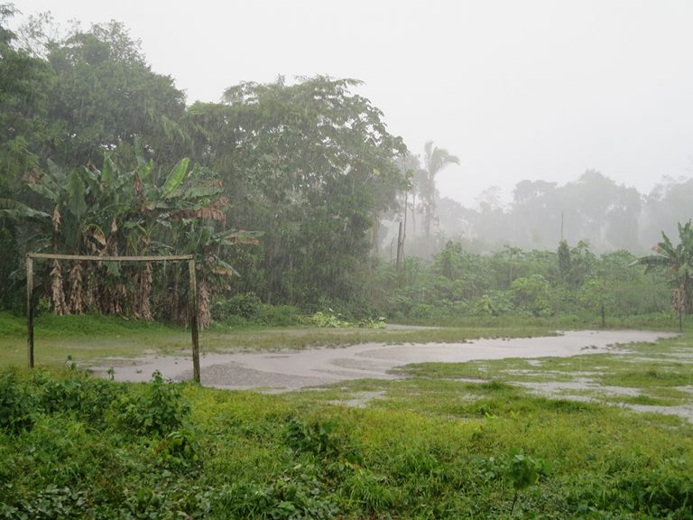
In the small village of Sawré Muybu, situated on a rise above the Tapajós River, Munduruku boys are playing soccer on a dirt pitch bordered by forest. Other community members seek a snooze in hammocks where companions are a mere foot away. There’s a feeling of playfulness and rest after the hard work this morning of hiking through the humid forest to place the first metal placard marking out their lands. An afternoon storm descends with force, and everyone seeks shelter beneath palm-frond roofs. The raindrops turn the air pleasantly cooler.
One barraca, a communal building without walls that Greenpeace and the villagers built together, is leaking badly, so a dozen people in the rain coordinate between the roof and ground as they try to sling a tarp over it.
It’s a pause in a busy time around here. The Munduruku from the middle region of the Tapajós are taking their future into their own hands: They are planning the auto-demarcation of their territory of 178,173 hectares. Though it is the role of the federal government to officially demarcate the territory by approving the land’s homologation and physically erecting official placards at agreed-upon points to declare its protected status, the Munduruku are replicating this process by marking out their territory with placards on the exact spots approved during the first three steps of the official demarcation process. It’s an act of resistance against a federal government that has so far refused to complete the last of four steps to formally carve out their land as indigenous territory, also known as Terra Indígena or TI, although the Munduruku have dwelled in this Amazon basin from time immemorial. Munduruku is the name that the Portuguese gave to the people and to the language that the indigenous group speaks. To the outside world, this ancestral land in the Middle Tapajós is called Sawré Muybu, but to the Munduruku, it is Daje Kapap Eypi. They have asked Greenpeace for technical assistance, including providing the placards they will be putting up to delineate their borders.
They are working to halt the building of the proposed São Luiz do Tapajós megadam, which would extinguish their lands with water. It’s not just flooding, but also illegal mining and illegal lumber extraction that pose threats to their lands. No federal or local enforcement body is willing to protect them from these extractive ravages in any consistent way. Once the possibility emerged of President Michel Temer being investigated on corruption charges for supporting bribes to construction companies, he only threw his weight ever more forcefully behind the increasingly powerful pro-deforestation and pro-agribusiness ruralista caucus in Congress. This gave them public parcels of land and key legislation in the hopes that they would vote against trying him. To save his skin, Temer would slash the funding of FUNAI (Fundação Nacional do Índio, the National Indian Foundation) and IBAMA (Instituto Brasileiro do Meio Ambiente e dos Recursos Naturais Renováveis, the Brazilian Institute of the Environment and Renewable Natural Resources), impeding the ability of both organizations to enforce the territorial integrity of indigenous territories. In addition, Temer would pass legislation to allow squatters in public parks to remain without any fines, and he would reduce the protected area of Pará’s Jamanxim National Forest, signaling to elected officials from Congress’ agribusiness block (bancada ruralista) that he would do whatever it took to open these areas to profitable extraction.
The Middle Tapajós Munduruku are not alone. Indigenous and traditional communities throughout the Tapajós River basin are facing increased degradation of their environment and the cultural sustenance practices that form the foundation of their lifeways. The Tapajós River runs south to north through Brazil’s Amazon, from the state of Mato Grosso to the state of Pará. The São Manoel and Teles Pires dams have recently begun operations on the border of the states of Pará and Mato Grosso to the south of the village. Ever since the Teles Pires dam company removed ceremonial urns years ago during dam construction, the Upper Tapajós Munduruku have been fighting to re-establish possession of these urns, which they believe are guarded by the mãe dos peixes, the mother of fish. Along with the Apiaká and the Kayabí peoples, the Munduruku charge that the consultation of indigenous peoples required prior to construction did not occur, and they demand that it must occur on all future projects. Because of increased sediment caused by the dams, nearby indigenous peoples in the south of the basin report that they are no longer able to fish with bow and arrow because they cannot see into the water, and so they have to travel long distances by boat in order to find food, using precious petrol. Due to changes in water quality, residents in villages near the dams say that drinking the river water may cause nausea and headaches. When they bathe in the river, bumps rise on their skin. Scientists report that these rashes are due to algae blooms, which are caused by the low circulation of oxygen as a result of the dams’ alterations to the river’s flow. In the dam’s large reservoir, the water is generally stagnant, but the dam company releases water to produce energy, which in turn results in sudden large flows that local people report to be similar to ocean tides. In the Tapajós River basin, indigenous and other river communities are struggling against a total of forty-three medium-to-large dam projects (proposed, implemented or under construction), as well as hundreds of small dam projects, and their voices aren’t making headlines. So I have come to Pará to find out what’s motivating the Munduruku to pound poles into the ground and affix placards to demarcate their own territory.
*
Margareth Akay Munduruku, forty-five years old, sits on the stoop as the last light from the west over the Tapajós River filters across her face. She runs a hand through her hair as she explains, ‘Our hair is falling out.’ Due to the mercury that illegal gold miners shoot into the riverbed, the Munduruku here are eating fish contaminated with traces of the poisonous metal. Mercury in drinking water is also associated with brain damage. A widowed mother of eight, she is humble and speaks quietly, with pauses between her sentences that the Tapajós’ inky dusk fills in.

Margareth Akay Munduruku on the morning of the auto-demarcation protest.
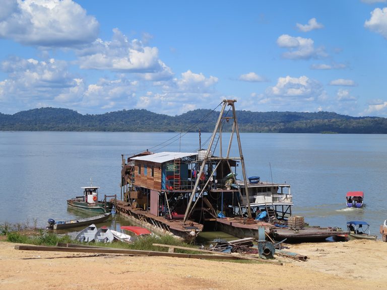
‘Before white people, before the gold miners, the water was very clear. Now we can’t see the bottom of the river,’ Margareth recollects. The gold boats use powerful hoses or dredge the bottom of the river for rocks, which are then mixed with mercury and heated in order to separate out the gold. Smuggled through Bolivia, forty tons per year of this illegally extracted gold ends up in the United States, according to a 2016 study by US-based watchdog group Verité. Though in the past the water was ‘transparent,’ she says. ‘The fish die, go away. Now the water turns brown.’ The boats disturb the bottom of the riverbed, leaving the water murky.
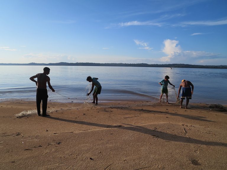
Since Margareth’s husband passed away last year, she has gone hunting and fishing with friends or her children. Her voice turns to a joyous singsong as she lists off all the different animals they hunt for and find, catitu, porcão, tatu, anta, viado, jucú. Whether they find a small or a large animal, when they return to the village, they share equally with everyone. Each family gets their portion of meat. Margareth speaks of this as an important part of their convivência, their way of living together. ‘Everyone respects the village, shares everything, shares food.’
But these days fewer animals are available to hunt and fish because of incursions on their land. Margareth describes that when they were surveying the land for auto-demarcation, they came upon an area not too far away that had been cleared by illegal loggers. ‘They take all the big trees and leave only chunks behind.’ This scares the animals away.
She goes on to describe more changes, ‘Now the fishermen come from outside to take fish.’ The fish are sold in the fish markets of Itaituba, about fifty kilometers north of Sawré Muybu. ‘The fish are disappearing. I have eight children. What will I feed them? We used to be able to fish in order to feed ourselves. Now, my children might spend the whole day out fishing, only to return with a few fish.’ She explains that they hunt to try to make up for the deficit.
As we talk, the dusk has turned to dark. We sit on a low stoop, knees bent, while beyond our eyesight below is the wide Tapajós River, their home, now the object of so many outsiders’ designs. Though official maps label it the Tapajós River, with its tributaries the Teles Pires and Juruena Rivers, the Munduruku regard these as one single river, the Idixidi. She goes on, ‘Every time, more white people are coming, and they are always taking something away. I am afraid for my children. I don’t know if they will have any future here.’
From the driver who brought us here to the Munduruku leaders, everyone remembers what happened at the Belo Monte Dam. The dam is the world’s third largest hydroelectric dam, situated in the northern state of Pará. The Munduruku and ribeirinho communities – residents of traditional river-dwelling communities, most dating from the Amazon rubber boom from a hundred years ago – acting in support of Xingu tribespeople, traveled to join encampments in protest of the dam. Together with ribeirinhos and Kuruaya, Asurini, Parakanã, Xipaya, Caiapó, Arara and Tupinambá peoples, the Munduruku occupied the dam’s site office in 2013. Their main demand was that judges suspend both Belo Monte operations and studies for dams on the Tapajós River until indigenous peoples in both places had been consulted in accordance with United Nations declarations and International Labour Organisation’s Indigenous and Tribe Peoples Convention (169), both of which require free, prior and informed consent of indigenous peoples affected by any proposed projects. The Belo Monte dam project violated the Brazilian constitution, which does not allow for the removal of indigenous peoples. But in the end, Brazil invoked the military dictatorship tool of the Security Suspension, stating that energy was a matter of Brazil’s national security. So the dam went through, displacing 40,000 people. 16.2 tonnes of fish were killed as the reservoir filled in February 2016, and the companies’ legally binding promises of mitigation were all unkept by the time of the completion of the dam – from the promise of trash service and basic sanitation (running water and sewage) in Altamira to the promise of the relocation of peoples so that they could live along the river once again. With this frightening example of a hydroelectric dam’s impacts, and after years of stalled applications for federal demarcation, the Munduruku have decided to do it themselves.
Awakening in the village of Sawré Muybu, I hear a sound I’ve never heard before. Whoooo—whiiiiiiii—whooooo—whiiiiiiiieee! It emerges from the treetops beyond my feet. There are no walls where I’m sleeping with thirty-five other people. I turn in my hammock, drawing its folds the tighter around me, but peek my face out of the cocoon. The sound whirs higher in the green forest. The monkeys’ wide, swinging conversation is like the movement of a tight flock of birds above water, swiftly careening up and down, the rapid turns of their triangle quickly shifting the apex above or below. No individual decision-making is discernible, but they know, and move accordingly. It’s time.
*
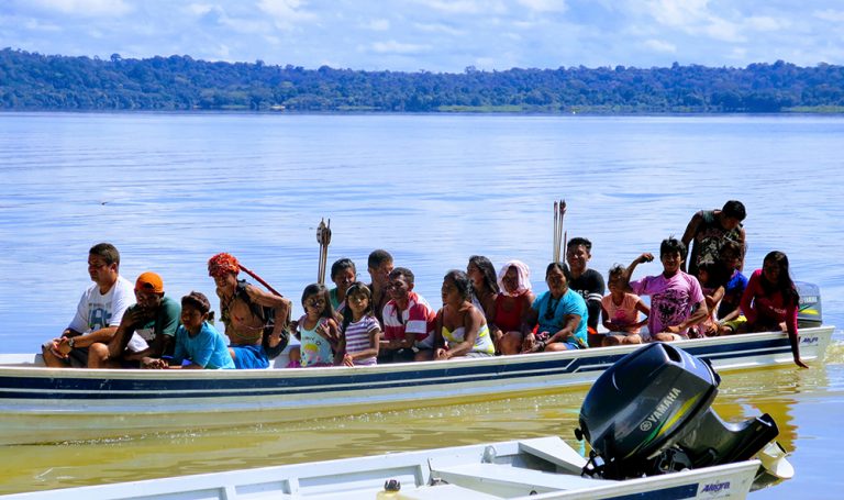
Thirteen caciques and their families, some having traveled three days to get here, are gathered by the water. A cacique is head leader of their village, with the power to make decisions on its behalf. Soon we are seated close to one another on the boats, waiting, while the sun grows higher, pushing its insistent beams. At a signal, the boats motor into action. The Tapajós River grows wide around us. The sun ripples over the water, and the two embracing banks of the river sprout their walls of green palms. The prow cuts through the waves.
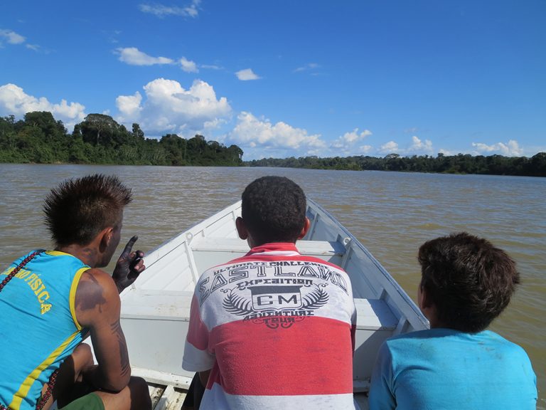
The boats diverge as one boat goes one way around rapids, and another boat cuts a different path to the other side. The caciques wear feathered caps on their heads, gathered from birds they’ve come upon in the forest. Many wear a long strand of açai and other seeds doubled over so that it crisscrosses between their brown breasts, looping below their armpits to cross again between their shoulder blades. Most are painted with purple-blackish symbols that represent different animals whose qualities they would like to bring to bear on the situation. A pattern on someone’s arm that at first seems abstract is actually the plates of a turtle’s shell – the turtle is emulated for its perseverance. The caciques mostly wear shiny seed strings of red or brown or black. Their hats made of bright bird feathers are more striking when I picture each feather being gathered by hand. They sit silently in the boats, one hat in red and grey, another in all yellow, another in a startling blue.
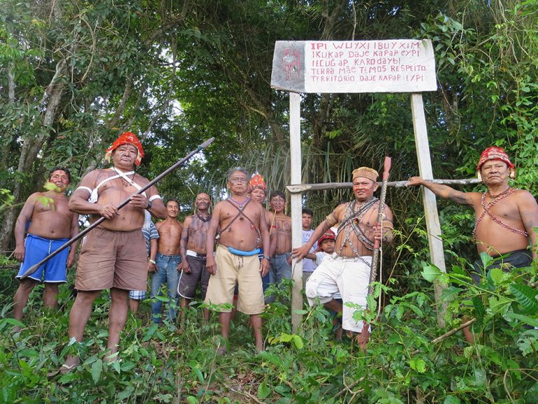
In a fifteen-foot wide parting in the forest, the caciques climb the slope and gather on the slight rise above the river. The caciques and young men gather proudly on the crest of the slope around an older, wooden placard to the right of where the new one will go. There is an expectant, excited feeling. Men quickly pull out stray bush branches from the slope and then begin to dig a hole in which the new wooden pole will be hoisted. The bright-feathered hats light up the hillside. Across a young man’s back is strung a quiver of five-foot-high arrows, not ceremonial garb but rather tools at the ready should he come upon prey in the forest. The older caciques hold spears three- to four-inches thick, carved with handholds every foot or two.
Meeting of the Waters
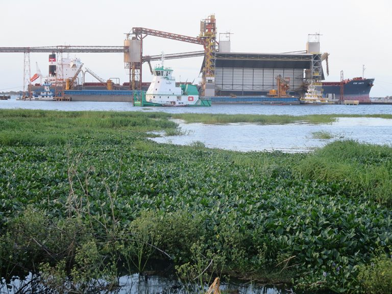
Santarém. The journey to Sawré Muybu over the last week has been full of signs as to why the Munduruku so urgently need to demarcate their land. The city of Santarém, the northernmost port on the Tapajós, is the uppermost point of Brazil’s soy river highway. In the shadow of multinational corporation Cargill’s Amazon port, I listen to the mechanical whirring of grain and soy being passed through orange chambers hundreds of feet above my head.
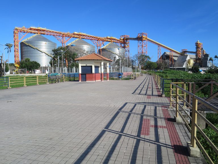
Out in the sea, men hose down an enormous black-bottomed, moored Cargill ship. Part of the motivation for the hydroelectric dams is to facilitate agribusiness bringing soy and other grains from the biome of the cerrado, in the center of the country, north to Santarém for export. Soy is easy feed for livestock such as the cattle that drive the national beef industry. But soy is coveted beyond Brazil’s borders as well; China promised Brazil a $20 billion investment for infrastructure projects to move soy and grains from the interior to the coast, particularly the controversial Ferrogrão, a grain railway that would pass ten kilometers from Sawré Muybu and directly through other indigenous peoples’ lands. The land is marked by a rough river riven with rapids and waterfalls, many sacred to the Munduruku. The agribusiness vision of a river highway is intent on flattening those contours.
Santarém lies at the confluence of two great rivers; the creamy coffee-colored Amazon River and the Tapajós, referred to as green in local parlance, though it looks relatively clear to my eye. Where these rivers travel side by side is called the Meeting of the Waters. There is another, perhaps more dramatic, meeting of the waters to the northwest of here, near Manaus, where the acidic black waters of the Rio Negro meet the brown waters of the silty Solimões River. But for the Santarém hotels, restaurants and keychains bearing its name, theirs is the only Encontro das Águas. To get to the Cargill port, I have walked a block from my Santarém hotel on Rua Floriano Peixoto, down past the Catholic Metropolitan Cathedral’s plaza, where market vendors have strung up small stalls that create a bit of shade, its boundaries formed by colorful hanging hammocks.
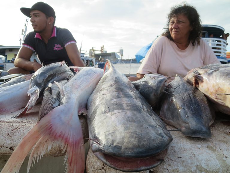
To the left is a twenty-two-foot-long pounded metal fish, a sculpture of the golden-scaled dourado fish that graces these waters and the stalls of the early-morning fish market that takes place a few blocks south. On the main street that runs along the shore, the cement embankment holds the riverbed. Dark metal rings are fastened into the cement halfway through; men climb up the incline to fasten their boat’s rope onto the ring to moor. Near us, the water is quite clear – that’s the Tapajós. Out a distance of a kilometer or more, past fishing boats, clear water turns to brown – this is the Amazon, having carried its ever-growing load of organic sediment all the way from its headwaters in Peru’s Andes. A discernible line divides the two bodies of water. As I stare out on the wide swath, the rivers are colleagues, companions, rustling amicably alongside one another.
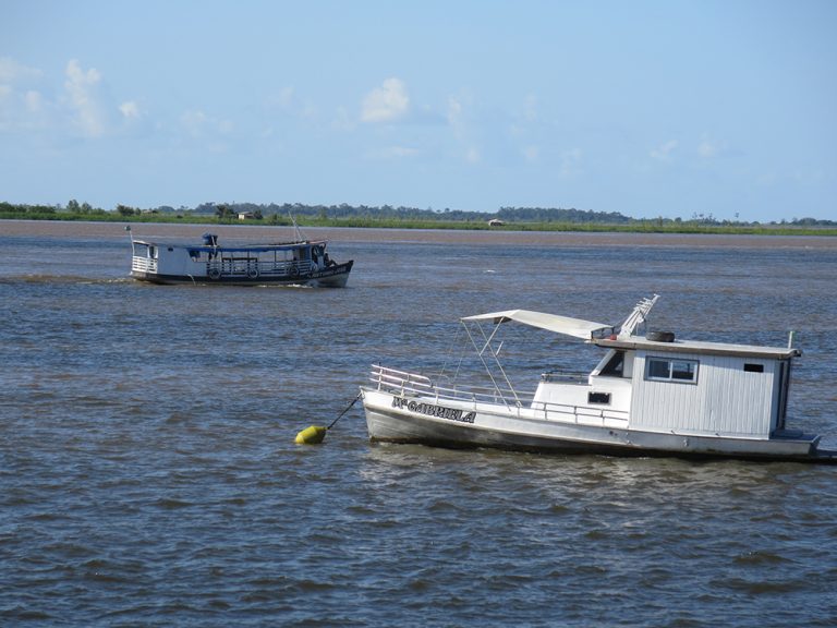
I stand and watch men line-fishing from the embankment. They work the line deftly, little plastic bags where they keep their catch at their feet. Further out the rivers, three canoes are clustered. I can make out a man almost continuously bailing out water from the wooden plank canoe while his two companions do the fishing. There seems to be a life philosophy here: don’t let a little leakage stop you from taking the boat out; there will be leakage, but just scoop out the bilge.
I wonder if my eyes are playing tricks on me – are those white cranes really perched on the side of the boat, near the fishermen, or are they just close? One boat perhaps is the luckiest – three wide-winged cranes perch on its edges, as many as the men in it. The crane must be just an arm’s length from the men fishing, but they cohabit harmoniously. The fishermen on the slim canoes are fishing with the cranes, guided by them as if by patron saints. The cranes spread their wide wings as if to fly away, but remain on the lip of the boat, the impressive span of their wings appearing broader than the slim craft. In a magical theatre of shadow-play in grey-blues, the cranes resettle on the boat’s brim as the men continue to fish.
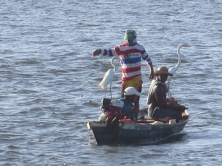
After a week of waiting in grey Santarém, I get the call from Greenpeace to join them going south on the river to the Munduruku as they auto-demarcate their lands. They’ll transport me there on a small boat from Itaituba, the jumping-off point for a host of extractive activities. Tens of thousands of people press their pincers on the area’s land.
The boat I take to Itaituba is not one of those romantic Amazonian steamers slung with colorful hammocks, that I’ve been longingly eyeing. Instead, the lancha I take is a kind of flat-bottomed speedboat. Passengers for the most part kick back their seats and close their eyes, willing themselves to pass the boredom of the trip as people back home do on airplanes. In the row behind me, a man in his fifties with a female companion, and with tanned skin, grey-blondish hair swooped to the side, stares at me with hazel eyes. I ignore his gaze, staring ahead, but am unnerved, wondering why I’m being watched.
To travel as a woman alone is to wonder such things. With my long red-blond hair and curious countenance easily identifying me as a tourist, I stick out. I can’t seem to wipe the wonder from my face. I wear beige easy-wicking trousers and a sensible hat, so it’s not unreasonable to peg me as a Friend of the Trees, in other words, an enemy of the economic activities that predominate here, many of them illegal. According to Global Witness, at least 448 environmentalists were killed in Brazil between 2002 and 2013. In 2016 alone, 61 land campaigners were killed, according to Brazil’s Pastoral Land Commission (CPT), up from 50 the previous year. The murders of land protectors are on the rise. I hear the voice of my fellow Brazilian literature translator, telling me over and over with concern, ‘I was in Brazil when they killed Chico Mendes,’ the organizer of the rubber tappers who was assassinated in 1988, even though he had four bodyguards. ‘But maybe you’re not important enough to kill,’ my colleague adds. I am counting on that to be true.
As the motor cranks up, taking us southward on the Tapajós, the banks of the river widen until you can’t see the other side. It’s the music of the journey I’ve been waiting to hear. Goosebumps grow on my arms, whether from the excitement or from the A/C in the lancha, I can’t tell. I push the blue cloth curtains to the side. The low palm-sprouted banks of the river entrance me though there are few entryways into them. The horizontal line of greenness drawn by palm leaves diverges in various patterns, and I think of French explorer-geographer Henri Anatole Coudreau’s book, Voyage au Tapajoz, with its delicate watercolors of all the varieties of palms he saw on his 1895–96 journey. Though some would see unbroken green, I can’t stop watching the particular silhouettes of the leaves.
A storm descends and fogs the sight lines so there is only one bank of the river, the other lost beneath low cloud. Rain hurtles at the plexiglass window. Waves gurgle onto the glass by my chest, slosh high in lancing curves like the silhouettes of river dolphins, mocking my illusion of remaining separate. The pilot doesn’t let up, at the same high speed he jams the prow across the churning, storm-crested waves. The boat dives up and down from the force of it. While I tense, wishing he would slow down, the passengers around me sleep.
*
Itaituba, 228 miles south of Santarém on the Tapajós River, truly seems like the Wild West: a place of unenforced laws, full of men seeking fortunes, taking what they can from the land. The city shows me how many people – miners, loggers, land-grabbers – have designs on the property of the Munduruku and the ribeirinhos. There are storefronts advertising that they buy and sell gold; even the morning bakery is named The Bread of Gold (Pão de Ouro). Federal University of Western Pará archaeologist Bruna Rocha has told me that there are around 60,000 gold miners in the Tapajós region, and this is their departure point into outlying areas.
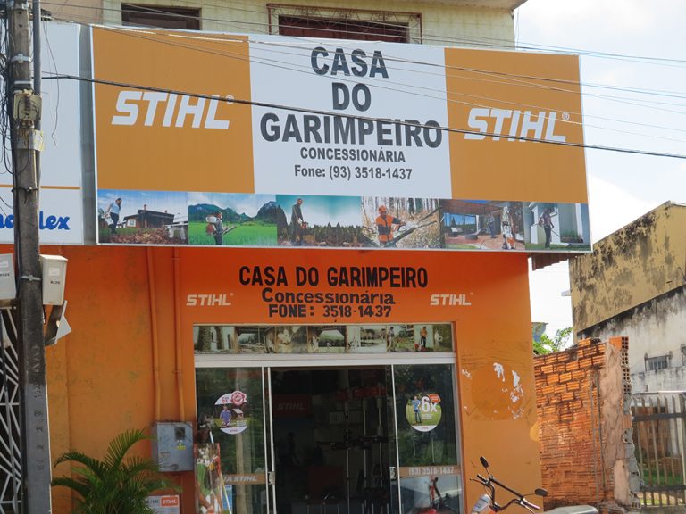
Most stores here, just off the Trans-Amazonian Highway, are focused on the extraction of materials. I stop by the House of the Miners (Casa do Garimpeiro), where the manager tries to sell me a chainsaw that’s labelled as being ‘Perfect for Reforestation!’ when it clearly is meant for just the opposite. He also assures me that he can get me an environmental license from IBAMA to go with that chainsaw. I snap a pic of the saw and, just as light dawns in his eyes that I’m not really in the market for a deforestation tool – he stammers that all licenses have to be legal – I push my camera into my bag and walk briskly away.
I walk a block to the Trans-Amazonian Highway, just a two-lane street here. A construction company has set out large sheaves of lumber in front.
Next to it, a Honda dealer appears to sell only motorcycles, a long line of them visible inside the glass showroom, protected from the orange dust. Since motorcycles are so much cheaper than cars, it makes sense that it would be the most viable vehicle in an area where people existing on the margins of the economy are now acquiring purchasing funds.
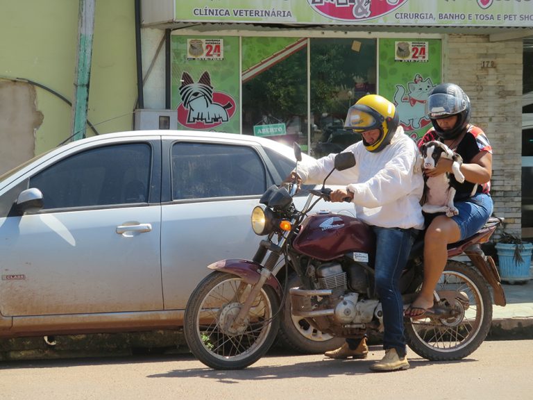
Stopping in a tree’s scarce shade in a plaza, I watch a couple and a dog, all precariously balanced on one motorcycle, drive up to a veterinarian’s office, the presence of which seems to indicate the existence of at least a small middle class. I catch the woman’s eye as she tries to get herself and the dog off the bike, and we share a whimsical look at the comedy of the moment.
*
The Trans-Amazonian Highway is not entirely made of asphalt. We are soon on a red-orange dirt road, in our dust-spattered black truck. The driver explains that the Trans-Amazonian Highway was running in 1974, its construction ordered by the military dictatorship. It goes all the way to Altamira and the Belo Monte dam, which came online only in May 2016, but was also conceived of by the military dictatorship in 1975. The generals’ Big Projects economic plan not only fit into the national narrative of modernizing and civilizing a supposedly untamed place, but also relocated some of the poor from Brazil’s drought-stricken Nordeste to work on the projects in a bid to head off social unrest. The Trans-Amazonian continues eastwards past Altamira to Anapu, where American nun Dorothy Stang was killed in 2005 because of her environmental defense work, the driver tells me.
Every so often there is a tiny outpost, a grimy restaurant with dusty chairs out front. Its customers seem to be only men. We pass the Parque Nacional da Amazonia, whose small sign would be easy to miss. Nearby, a group of eight to ten men is pulled to the side, standing by the shore of a wide river, perhaps to fish. I get the clear feeling that this highway slashed through the Amazon is not a place for women.
*
On the side of the road I catch sight of a yellow dog. Since all my dogs have been Labradors of some sort, I perk up. As we near it, I see that the dog is lying on its side. This is not unusual, as dogs in Brazil have freer rein than in the US. Around the yellow dog on the red-orange dirt is a circle of five or six urubus, the imposing black birds the size of a turkey. A couple of urubus are bent over the yellow dog’s side, their beaks pressed onto the side of the dog’s belly. No! I think as we speed by, shaken by the strangely symmetrical image, a macabre Tarot card.
After a couple hours’ drive, we veer off and stop with a view of the wide Tapajós River. Down by the river itself is a two-story building that also seems like a boat. It looks pretty permanent. I’m told it’s a barge for mining gold. We are transferred into two slim metal boats, low-slung, almost like canoes, with a single motor on the back and a steering mechanism. Luggage goes in the center between metal slats. These aren’t Munduruku boats, they are being rented by Greenpeace, which I guess explains why there’s a Brazilian city gringo at the back doing the steering. We’d better hold on tight, as the rapids coming up are dangerous, warns Danicley de Aguiar, a Greenpeace forest organizer. Everyone seems so placid about the prospect. From my perch on a metal slat, I wonder what exactly I should hold onto.
A small Munduruku man in his thirties, clad just in blue shorts, comes to sit on the prow as we set off. Every now and then, he fishes his hand through the air to indicate left, right or around those below-water rocks. Our boat swerves according to his weaving gestures. I start to become mesmerized by the melody of the conductor’s gently swooping hands. Except every now and then the Munduruku turns back to the driver and repeats the same sign, once or even twice. A hint of How could you not understand what my hand clearly just said? flickers across his face.
Munduruku Auto-Demarcation
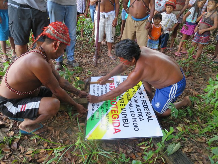
When we arrive, the banks of the Tapajós River are crowded with the caciques and their families. We’re several kilometers north of the village of Sawré Muybu. The leaders’ mien is serious, and they sport spears and arrows in the small forest clearing. The new, shiny white placard is ready to be posted. Men and boys dig a hole for a wooden post. Two caciques use a hammer to pound nails into the metal placard to affix it to the post on the ground. Then, they insert the post into the hole. Everyone watches in anticipation as the post with the new metal placard is lifted. A young man thrusts his arrows into the air, while the caciques hoist their thick spears, blades up, and everyone calls out, ‘Sawé! Sawé!’ It’s an interjection of power and approval of the auto-demarcation of Sawré Muybu.
Above our heads, the large metal sign displays an imitation of the official format used by FUNAI: black block letters on a white background, with green and yellow diagonal bands from the left topmost corner to the bottom right corner. This will be visible to anyone on a boat in the river, and perhaps the Munduruku’s hope is that the verisimilitude of the design – the colors, the citing of law codes, the bigger red letters for the words protected land – will deter anyone thinking about logging or mining on Sawré Muybu.
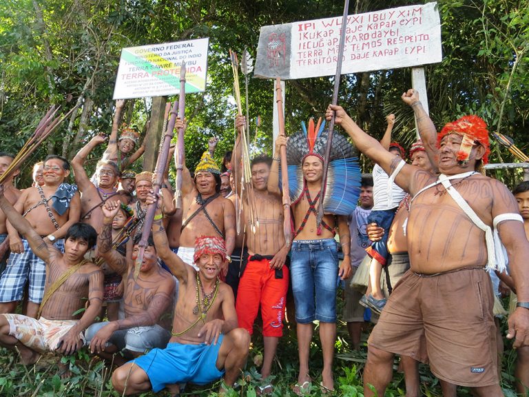
Next to it, the old, wooden placard is affixed onto two posts, the wood curling a bit at the corner from the moisture. It’s painted white with red letters, except for a side panel, painted black, that shows a man whose body has been lined with the signature marks of the warrior’s society. He holds a pole with a head on it, blood streaming from its nostrils and neck. Apparently this was meant to be warning enough to outsiders. The words identify the name of their land not as Sawré Muybu but the Munduruku name, ‘daje kapap eypi territory’. Above that line is this one in Portuguese: ‘terra mãe temos respeito’ (‘mother earth we have respect’). It seems a poignant hope that their own stipulation of faith and respect would inspire outsiders to do the same. Evidently, that inference turned out to be false. After two years of making a dozen or so of their own wooden posts, the Munduruku forged an alliance with Greenpeace to use technology to cut metal placards that a graphic designer has crafted to mimic the official placards, the Ministry of Justice would have made had they approved the demarcation. In place of articles of faith and bleeding heads, now there are legal codes, three of them.
federal government
ministry of justice
national indian foundation
terra sawré muybu
protected land
entry forbidden to outsiders
article no. 231 of the federal constitution
article no. 18, 1st law no. 6001/73
article no. 161 of the penal code
Juarez Saw, the chief of Sawré Muybu, gives a speech that explains why they are auto-demarcating their lands. And he’s got a lot to cover. The Munduruku efforts to work with FUNAI on a federally demarcated indigenous territory constituted a long trail of disappointments. But in the end, ironically, it was FUNAI that coordinated and chose the geographical location for each of the border markers, and it’s these exact points that the Munduruku are using in their present auto-demarcation, to lend the process a semblance of legal force. Cacique Juarez’s chronology begins back in 1998, when the Munduruku began their struggle for federal recognition of their rights to their lands. They began working with an anthropologist at FUNAI, spending years gathering the required documentation and expert reports, but then ‘she disappeared without completing the report’. The disappointed Munduruku had to start all over again with a different team from FUNAI, and more years passed in the assembling of the required experts’ studies. After completing this study with a new FUNAI-appointed anthropology coordinator, the Munduruku were promised that in ninety days the study would be brought to the government for approval. FUNAI returned to the village with sad news in early 2016, says Juarez. Due to the planned São Luiz do Tapajós hydroelectric dam, the government had rejected their application for demarcation of their territories.
For the Munduruku, who survive by fishing, hunting, and small-scale gardening in the forest, the coordination required to seek and assemble hundreds of pages of academic and other expert testimonies and documentation was nothing short of incredible. They had done all that, and yet had come up short due to the Brazilian government’s desire to pursue large-scale hydroelectric projects.
And it was then, according to cacique Juarez, that they began to speak more with the Upper Tapajós Munduruku and coordinate with their neighbors, the ribeirinhos and international groups in order to strengthen their struggle.
Coordinating with the Upper Tapajós, the Munduruku started placing the handmade, wooden demarcation placards in protest, thirteen in total. They placed placards at the points already designated by FUNAI. ‘We couldn’t wait any more, not knowing what FUNAI would do’. They had been disappointed by FUNAI so many times.
‘Now Greenpeace has made placards,’ he explains, fabricated in metal instead of wood. ‘We don’t know if they will recognize it or have respect for this, but we hope that they will.’
In the forest clearing, the leaders go to the front, face us and speak. Danicley, the Greenpeace organizer, explains to the outsiders that at the edge of the river we are in ‘alluvial forest, which floods seasonally, part of the year dry, part of the year wet’. If the hydroelectric dam is built, he says, this seasonal flooding ‘will be completely lost’. It plays an important role in the life of creatures of the forest, for ‘fish and animals pass’ from the river into the flooded forest. This flooded riparian corridor is crucial for dolphins, turtles, fish and other animals to travel through and to birth their young. Their ‘nurseries’ are often located in these igapós, flooded forest areas on the margin of the river. Slightly shallower than the river itself, they provide hospitable environments for egg laying and the raising of young fish. The Teles Pires dam has inundated nearby igapós, diminishing fish and turtle populations.
A cacique adds that ‘the açai will drown too’, should the dam be built. Açai, of course, is the small purple forest fruit that is used for adornment, for example, in the long strings of beads that the caciques wear across their torsos. The cacique continues that ‘fifty tonnes of fish per day die at Belo Monte’, the megadam to the northwest of here. Belo Monte is about five hundred kilometers as the crow flies, which means the Munduruku spent more than a dozen hours on boat and bus to support their Xingu sisters and brothers in their years-long struggle to halt the dam. ‘The Munduruku went to Belo Monte,’ the cacique recounts. ‘The Xingu cried in front of them, and the Munduruku cried too.’
The caciques, gesturing to the riparian forest around us, explain how the fish eat fruit that has fallen in the water. This is the exchange between terra firma and flooded riparian land that scientists say is so crucial to water systems’ interconnectivity with forests.
With concern in his voice, a red-hatted cacique says, ‘When the Munduruku go into the forest to hunt on the eastern border, we encounter illegal loggers there. We ask them to leave but they don’t. The police are absent. We complain to the police, but they don’t do anything. The intruders log trees that have fruit that lure the hunt. The machines they use to cut down trees make a lot of noise and that scares away the animals too.’
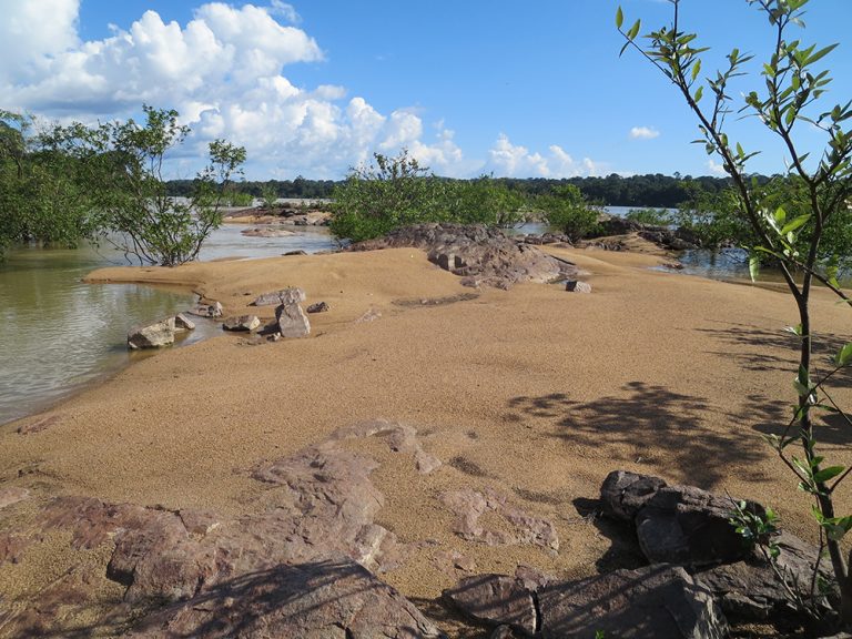
At the pedrão, an area of large rocks in the middle of the river, exposed in certain parts of the year, the kids learned to fish. There’s a certain kind of fish that comes here just to eat the wild guava (araçá) fruit that falls into the shallows between the rocks.
A Munduruku man quietly says, ‘If the rocks disappear, the fish will too. The fruit feed the fish.’ This is borne out by reports of what has happened after Belo Monte Dam was built. Cacique Bel Juruna describes her eyewitness experience: Brazil trees by the edge of the water suddenly stopped giving fruit. Fish began to rot while still living in the river, their skins falling away in macabre fashion. Similar reports of fish rotting alive have emerged from communities near the São Manoel and Teles Pires dams to the south.
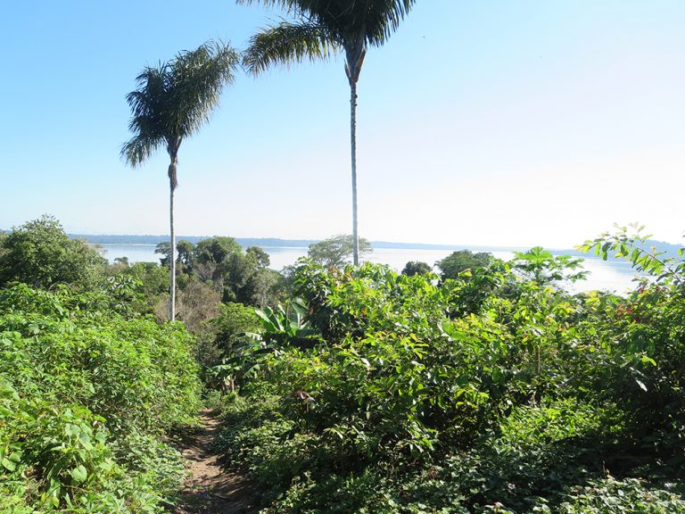
Back in Sawré Muybu after dinner in the palm-frond-covered building that houses the internet connection (run by solar panels that Greenpeace built, and will leave behind), the volunteers are quietly focused on their devices. Few people talk with one another during these scarce hours of Wi-Fi time. I happen to look over the shoulder of one volunteer and see a map of what seems to be the land of the Middle Tapajós Munduruku, with points lit up in colors.
‘This is the map with the different points for the placards,’ he says. ‘You don’t have one?’ The 8½” by 11″ map on soft paper is labeled ‘Proposed Placards: Sawré Muybu Indigenous Territory’. The volunteer enthuses, ‘What’s interesting is that we’re not just mapping the territory. We’re also mapping points of cultural significance.’ This is the first I’ve heard of it. ‘In fact, the very most important places of sacred significance to the Munduruku are not even on this map.’ He goes on to explain, ‘The Munduruku believe that they can’t represent on a map any significant sacred places.’ The irony of the map missing its most important points is not lost on either one of us.
*
By mid-July 2016, the Munduruku finished demarcating their borders with placards on forty-two points. On 4 August, 2016, Brazil’s Environmental Protection Agency ‘archived’ the plans for the São Luiz do Tapajós Dam, stating that the project’s environmental impact statement lacked sufficient content to assess its feasibility, and because it would require the removal of thousands of indigenous people from their villages, which would violate the constitution.
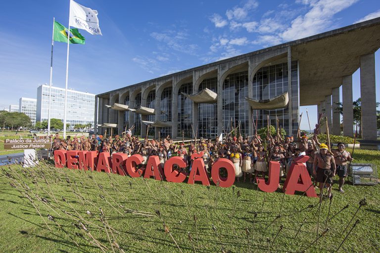
It’s a victory. But the Munduruku won’t be satisfied until the São Luiz do Tapajós Dam project is not ‘archived’ but officially cancelled. The Munduruku have kept up their protests against the lack of response to their new federal demarcation application, as well as demonstrating against the cultural, spiritual and ecological damages caused by the Teles Pires and São Manoel dams. In November 2016, the Munduruku dramatically shot 180 arrows into the Justice Ministry’s lawn in Brasilia to represent the passage of days they’d been promised a decision on their application. Behind the arrows, waist-high red letters formed the words demarcação já (Demarcation Now).
And then on 20 July 2017, in a major decision affecting indigenous peoples throughout Brazil, President Michel Temer signed his Attorney General’s legal report that discards pending indigenous demarcation applications when the peoples can’t prove they have continuously inhabited that specific land since 1988. The decree endangers hundreds of demarcation applications. The Attorney General’s measure moved to strip indigenous peoples of exclusive rights to their lands, opening them up again to hydroelectric dams, roads, mining, and other infrastructure.
The Munduruku Indigenous Territory, and hundreds of others like it in Brazil, are more vulnerable to looming local and federal incursions than ever. They will need more help than a few dozen metal signs.
Feature photograph courtesy of Greenpeace and Otávio Almeida
All photographs courtesy of the author, unless otherwise stated

